

New high resolution satellite image processing technology allows researchers to identify and count right whales at the ocean surface or to depths of up to 15 metres — described as a boon to tracking the health of whale populations.
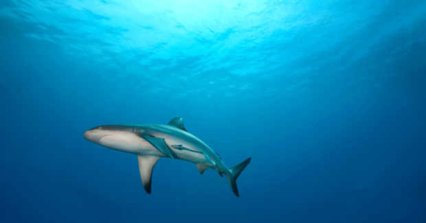
The very trait that pushed southern right whales close to extinction — lolling near the surface of warm waters — is helping to revolutionize the way whales are counted.
New satellite technology has allowed the use of high-resolution photographs and image processing software to detect the crustaceans at the surface or to a depth of 15 metres in shallow waters off Argentina.
High-res satellites are a cost-effective improvement over the way whale populations are currently calculated — narrowly limited counts from shore, a ship or a plane.
Scientists used the most powerful commercial observation platforms available can see surface features as small as 50 centimetres in black and white.
A test of the satellite’s image-recognition capacity, reported in the journal Plos One, detected about 90% of southern right whales swimming in the Golfo Nuevo on the coast of Argentina compared to a manual search of the imagery.
The accuracy surpasses previous attempts at space-borne assessment and could revolutionize the way whale populations are estimated.
“Our study is a proof of principle,” Peter Fretwell of the British Antarctic Survey told the BBC.
“But as the resolution of the satellites increases and our image analysis improves, we should be able to monitor many more species and in other types of location.
“It should be possible to do total population counts and in the future track the trajectory of those populations.”
For this study, Fretwell and his colleagues purchased a single, massive image taken in September 2012 by the WorldView2 satellite. The image covers 113 square kilometres including Golfo Nuevo, a circular gulf off the Argentine coast and an area where southern right whales are known to breed and raise their young from July through November.
By looking at the same image in different wavelengths, including one able to penetrate 15 metres beneath the ocean, the researchers were able to spot 55 probable whales and 22 possible whales in the gulf as well as 13 whale-shapes underwater.
“Satellite imagery provides much more accurate and wider coverage,” Fretwell told the Los Angeles Times. “If this works, we can take it out to many other species as well.”
These animals were driven to near-extinction in the early 20th century. Recognized as slow, shallow swimmers, they were the “right” whales to hunt.
For this reason, their numbers dropped from a pre-whaling population of 55,000-70,000 to just 300 by the 1920s.
“The same reason they are the right whales to catch makes them the right whales to look for by satellite,” said Fretwell.
Their numbers have seen something of a recovery, but without the means to carry out an accurate census, it is hard to know their precise status.
Scientists already have used satellite imagery to count populations of penguins in Antarctica, and Fretwell said similar work was being done with seals. The key to using satellites to track animals is not the size of the animal but how much it stands out from its environment, he said.


