North Pole now a lake

n pole

Instead of snow and ice whirling on the wind, a foot-deep aquamarine lake now sloshes around a webcam stationed at the North Pole. The meltwater lake started forming July 13, following two weeks of warm weather in the high Arctic. In early July, temperatures were 2 to 5 degrees Fahrenheit (1 to 3 degrees Celsius) higher than average over much of the Arctic Ocean, according to the National Snow & Ice Data Center.

Meltwater ponds sprout more easily on young, thin ice, which now accounts for more than half of the Arctic’s sea ice. The ponds link up across the smooth surface of the ice, creating a network that traps heat from the sun. Thick and wrinkly multi-year ice, which has survived more than one freeze-thaw season, is less likely sport a polka-dot network of ponds because of its rough, uneven surface.

July is the melting month in the Arctic, when sea ice shrinks fastest. An Arctic cyclone, which can rival a hurricane in strength, is forecast for this week, which will further fracture the ice and churn up warm ocean water, hastening the summer melt. The Arctic hit a record low summer ice melt last year on Sept. 16, 2012, the smallest recorded since satellites began tracking the Arctic ice in the 1970s.

http://www.livescience.com/38347-north-pole-ice-melt-lake.html

Sea Level Could Rise 5 Feet in New York City by 2100

sea level nyc

The U.S.’s largest metropolis and the entire east coast could face frequent destruction unless the region takes previously unthinkable actions

By Mark Fischetti

By 2100 devastating flooding of the sort that Superstorm Sandy unleashed on New York City could happen every two years all along the valuable and densely populated U.S. east coast—anywhere from Boston to Miami.

And unless extreme protection measures are implemented, people could again die.

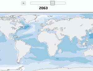
Hyperbole? Hardly. Even though Sandy’s storm surge was exceptionally high, if sea level rises as much as scientists agree is likely, even routine storms could cause similar destruction. Old, conservative estimates put the increase at two feet (0.6 meter) higher than the 2000 level by 2100. That number did not include any increase in ice melting from Greenland or Antarctica—yet in December new data showed that temperatures in Antarctica are rising three times faster than the rate used in the conservative models. Accelerated melting has also been reported in Greenland. Under what scientists call the rapid ice-melt scenario, global sea level would rise four feet (1.2 meters by the 2080s, according to Klaus Jacob, a research scientist at Columbia University’s Lamont–Doherty Earth Observatory. In New York City by 2100 “it will be five feet, plus or minus one foot,” Jacob says.

Skeptics doubt that number, but the science is solid. The projection comes in part from the realization that the ocean does not rise equally around the planet. The coast from Cape Cod near Boston to Cape Hatteras in North Carolina is a hot spot—figuratively and literally. In 2012 Asbury Sallenger, a coastal hazards expert at the U.S. Geological Survey (USGS), reported that for the prior 60 years sea level along that section of the Atlantic coast had increased three to four times faster than the global average. Looking ahead to 2100, Sallenger indicated that the region would experience 12 to 24 centimeters—4.7 to 9.4 inches—of sea level rise above and beyond the average global increase.

Sallenger (who died in February) was careful to point out that the surplus was related only to ocean changes—such as expansion of water due to higher temperature as well as adjustments to the Gulf Stream running up along the coast brought about by melting Arctic ice—not changes to the land.

Unfortunately, that land is also subsiding. Since North American glaciers began retreating 20,000 years ago, the crust from New York City to North Carolina has been sinking, as the larger continent continues to adjust to the unloading. The land will continue to subside by one to 1.5 millimeters (0.04 to 0.06 inch) a year, according to S. Jeffress Williams, a coastal marine geologist with the USGS and the University of Hawaii at Mānoa. The boundary zone where rising crust to the north changes to falling crust to the south runs roughly west to east from central New York State through Massachusetts.

Certain municipalities such as Atlantic City, N.J., are sinking even faster because they are rapidly extracting groundwater. Cities around Chesapeake Bay, such as Norfolk, Va., and Virginia Beach, are subsiding faster still because sediment underneath them continues to slump into the impact crater that formed the bay 35 million years ago.

When all these factors are taken into account, experts say, sea level rise of five feet (1.5 meters) by 2100 is reasonable along the entire east coast. That’s not really a surprise: the ocean was 20 to 26 feet (six to eight meters) higher during the most recent interglacial period.

Now for the flooding: Sandy’s storm surge topped out at about 11 feet (3.4 meters) above the most recent average sea level at the lower tip of Manhattan. But flood maps just updated by the Federal Emergency Management Agency in January indicate that even an eight-foot (2.5-meter) surge would cause widespread, destructive flooding. So if sea level rises by five feet (1.5 meters_, a surge of only three feet is needed to inflict considerable damage.

How frequently could that occur? Municipalities rarely plan for anything greater than the so-called one-in-100-year storm—which means that the chances of such a storm hitting during any given year is one in 100. Sandy was a one-in-500-year storm. If sea level rises by five feet, the chance in any year of a storm bringing a three-foot surge to New York City will increase to as high as one in three or even one in two, according to various projections. The 100-year-height for a storm in the year 2000 would be reached by a two-year storm in 2100.

With hundreds of people still homeless in Sandy’s wake, coastal cities worldwide are watching to see how New York City will fend off rising seas. Scientists and engineers have proposed solutions to pieces of the complex puzzle, and a notable subset of them on the New York City Panel on Climate Change are rushing to present options to Mayor Michael Bloomberg by the end of May. But extensive interviews with those experts leads to several controversial and expensive conclusions: Long-term, the only way to protect east coast cities against storm surges is to build massive flood barriers (pdf). The choices for protecting the long stretches of sandy coastlines between them—New Jersey, Maryland, the Carolinas, Florida—are even more limited.

As for sea level rise, retreat from low-lying shores may be the best option. Despite the gut reaction of “No, we won’t go,” climate forces already in motion may leave few options.

http://www.scientificamerican.com/article.cfm?id=fischetti-sea-level-could-rise-five-feet-new-york-city-nyc-2100

New map predicts timing of cities to avoid as sea levels rise

mg21729034_900-2_300

As the world warms, ice melts and water expands, sea level will rise – but faster in some places than others. These simulations, which assume warming in the middle of the range indicated by climate models, provide the best view yet of probable regional variation in sea level rise over the coming decades. Use the play button or slider to control the animations.

Click the link below to view projections for high or low emissions scenarios.

http://sealevel.newscientistapps.com/

SYDNEY, Tokyo and Buenos Aires watch out. These cities will experience some of the greatest sea level rises by 2100, according to one of the most comprehensive predictions to date.

Sea levels have been rising for over 100 years – not evenly, though. Several processes are at work, says Mahé Perrette of the Potsdam Institute for Climate Impact Research in Germany. Some land is sinking, some is rising. Stronger currents create slopes in sea surface, and since all things with mass exert a gravitation pull, disappearing ice sheets lead to a fall in sea levels in their surrounding areas.

Perrette has modelled all of these effects and calculated local sea level rises in 2100 for the entire planet. While the global average rise is predicted to be between 30 and 106 centimetres, he says tropical seas will rise 10 or 20 per cent more, while polar seas will see a below-average rise. Coasts around the Indian Ocean will be hard hit, as will Japan, south-east Australia and Argentina (Earth System Dynamics, doi.org/kbf).

New York’s position may be less perilous than previously thought. A weakening of the Atlantic Gulf Stream will cause water to slop westwards, triggering a rapid rise on the eastern seaboard, but this will be counteracted by Greenland’s weaker gravitational pull. The city is not out of the woods, though, warns Aimée Slangen of Utrecht University in the Netherlands, whose own model suggests that Antarctica could lose a lot of ice, which would produce an above-average rise throughout the northern hemisphere.

For now, Perrette offers a warning to tropical countries. “You may have 120 centimetres of sea level rise on your coastline,” he says. “Build defences.”

This article appeared in print under the headline “Where not to be when seas rise up to meet us”

http://www.newscientist.com/article/mg21729034.900-new-map-pinpoints-cities-to-avoid-as-sea-levels-rise.html

West Antarctica Ice Sheet is Warming Up

penguin

One of the big environmental stories of 2012 was the record melting of sea ice in the Arctic, which reached its smallest extent this summer since satellite data began being kept in the late 1970s. But it’s not the Arctic alone that’s reacting to manmade climate change by transforming into a large puddle. On the other end of the Earth, the continent of Antarctica contains enough ice to swamp just about every coastal city on the planet were it all to melt. The Arctic is transforming before our eyes, but it’s changes in Antarctica that could make Waterworld into a documentary.

That day is still in the distant future—in fact, sea ice in Antarctica has actually increased in recent years, as more powerful northward winds refreeze ice on the continent. But as a new study published in Nature Geoscience shows, temperatures are on the increase in the massive West Antarctica Ice Sheet (WAIS)—and so is melting.

Using data from Byrd Station, a scientific outpost in West Antarctica, researchers from Ohio State University and other institutions have report that average annual temperatures in the region have risen by 2.4 C (4.3 F) since 1958. That’s nearly twice as much warming as had been previously estimated, and the data shows for the first time an increase in warming trends during the summer. The timing of the temperature increase is particularly alarming because while temperatures in Antarctica remain well below freezing for nearly the entire year, the Antarctic summer is when any melting is likely to occur—just as it does in the Arctic.

As lead author David Bromwich put it in a statement:

Our record suggests that continued summer warming in West Antarctica could upset the surface mass balance of the ice sheet, so that the region could make an even bigger contribution to sea level rise than it already does.

Even without generating significant mass loss directly, surface melting on the WAIS could contribute to sea level indirectly, by weakening the West Antarctic ice shelves that restrain the region’s natural ice flow into the ocean.

Today melting from the WAIS adds only a few millimeters to the ongoing global sea level rise. But there is potential for much, much more—if all the ice in the 10 million sq. mile WAIS were to melt, it would be enough to add 3.05 m (10 ft.) to sea levels. To put that in perspective, all the warming the world has experienced since the Industrial Revolution has cause sea levels to rise by a few inches. That’s scary, world-changing stuff.

Antarctica: It’s Getting Hot at the Bottom of the Planet

Thanks to Ray Gaudette for bringing this to the attention of the It’s Interesting community.

NASA scientist links recent extreme hot weather to climate change

What do the 2010 heat wave in Russia, last year’s Texas drought, and the 2003 heat wave in Europe have in common?

All are examples of extreme weather caused by climate change, according to a new study from NASA scientist James Hansen.

“This is not a climate model or a prediction but actual observations of weather events and temperatures that have happened,” he wrote in a Washington Post opinion piece meant to accompany the study.

“Our analysis shows that it is no longer enough to say that global warming will increase the likelihood of extreme weather and to repeat the caveat that no individual weather event can be directly linked to climate change. To the contrary, our analysis shows that, for the extreme hot weather of the recent past, there is virtually no explanation other than climate change.”

The study, which was published by the Proceedings of the National Academy of Sciences, looks at the past six decades of global temperatures and finds what Hansen described as a “stunning” rise in the frequency of extremely hot summers.

It compared what is happening now to what was happening between 1951-1980. In those years, extremely hot temperatures covered less than 0.2% of the planet. Now, those temperatures cover about 10% of the land area, the study said.

It dismissed the idea that specific weather patterns are by themselves sufficient to explain today’s extreme anomalies. Phenomena like La Nina have always been around, but large areas of extreme warming have only come about with climate change, the study said.

“The odds that natural variability created these extremes are minuscule, vanishingly small. To count on those odds would be like quitting your job and playing the lottery every morning to pay the bills,” wrote Hansen.

Hansen directs research at the NASA Goddard Institute for Space Studies in New York and is a longtime environmental activist.

http://www.cnn.com/2012/08/05/us/climate-change/index.html?hpt=hp_t2