
New photos have appeared in Google Maps showing unidentified titanic structures in the barren Gobi desert, raising questions about what China might be building in a region it uses for its military, space and nuclear programs.
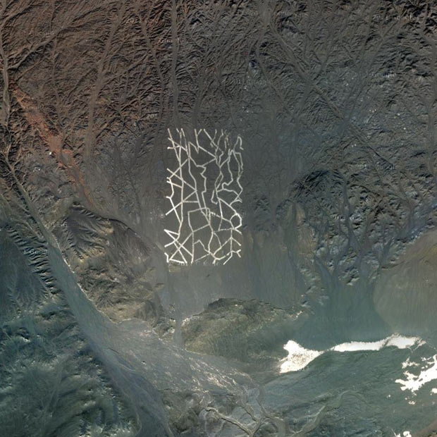
They seem to be wide lines drawn with some white material. Or maybe the dust have been dug by machinery.
It’s located in Dunhuang, Jiuquan, Gansu, north of the Shule River, which crosses the Tibetan Plateau to the west into the Kumtag Desert. It covers an area approximately one mile long by more than 3,000 feet wide.
The tracks are perfectly executed, and they seem to be designed to be seen from orbit.
Perhaps it’s some kind of targeting or calibrating grid for Chinese spy satellites? Maybe it’s a QR code for aliens? Nobody really knows.
You can check it out yourself in Google Maps here.

The second structure seems to be some kind of giant targeting grid, also north of the Shule river.
If you zoom in, you can see vehicles destroyed. It’s west of what seems to be a fairly big electrical station or a radio station similar to HAARP, the High Frequency Active Auroral Research Program located near Gakona, Alaska, and funded by the US Air Force, the US Navy, the University of Alaska, and DARPA.
